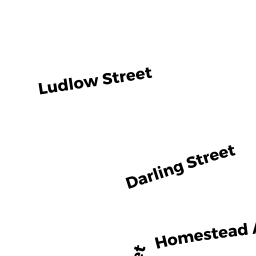
0019 DARLING STREET
Owner Information
DUPHILY SANDRA M
19 DARLING STREET
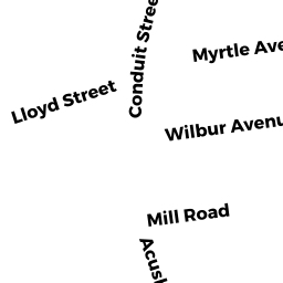
ACUSHNET, MA 02743


Property Details
0019 DARLING STREET is classified as a Single Family Residential (Cape).
The primary structure on this property was built in 1947. There are 2,589ft2 of built area within this property. There is 2,589ft2 of residential/living space within this property. There are 2 units within this property.
0019 DARLING STREET is valued at $396,100. The land is valued at $105,200 and the structures are valued at $275,700. There is an additional valuation of $15,200 on this property.
The most recent deed for 0019 DARLING STREET is recorded at the local registrar in Book 13669, Page 151. 0019 DARLING STREET was last sold on Thursday, February 25, 2021 for $425,000.
Assessment data from fiscal year 2021.
Flood Data
According to the FEMA National Flood Hazard Layer, this property does not appear to be in a flood zone. It may also be in an area not yet reviewed. Nonetheless, confirm this information prior to taking any action.
To view the flood hazards around this property, create a FEMA "Firmette" Map of the area around 0019 DARLING STREET.
Broadband Internet Providers
| Provider | Type | Bandwidth (mbps) | |
|---|---|---|---|
| Comcast | Cable | 1000 | 35 |
| Viasat Inc | Satellite | 35 | 3 |
| VSAT Systems, LLC. | Satellite | 2 | 1 |
| HughesNet | Satellite | 25 | 3 |
| GCI Communication Corp. | Satellite | 0 | 0 |
| Verizon New England Inc. | DSL | 15 | 1 |
Broadband service provider data from December 2020.
Adjacent Properties
- 0023 DARLING STREET
Single Family Residential owned by AUGUSTINE LOIS E - 0022 LUDLOW STREET
Single Family Residential owned by PICHE BARBARA LIFE ESTATE - 0026 LUDLOW STREET
Single Family Residential owned by MELLO MICHAEL A - 0032 LUDLOW STREET
Single Family Residential owned by BAPTISTA HUMBERTO M & SUSAN - 0013 DARLING STREET
Single Family Residential owned by HORNE FARRELL K